My habit of blogging about things I experienced several months ago leads to weird "blog time warp" situations. Case in point: my last post was a very recent picture and an abrupt departure from all the glorious Alaskan goodness that I have been sharing for several weeks now. Then, to top if off, Tammy and I took a trip to Asheville, NC this past weekend, which gave me a great excuse for not posting anything at all.
Now that we have returned from our trip (with a few pictures in tow), I am refreshed and ready to boldly resume the blogging bonanza. There are still, I think, some very interesting photos to share from the Alaska adventure, so I am going to push through those before sharing anything from this weekend's trip. And to continue through the Alaska photos means that I need to give a blogger's wave goodbye to Seward - it is time to move on to another location. And the perfect segue for that exit is a post about Exit Glacier, the location that served as the exit for the first recorded crossing of the Harding Ice Field.
As you drive out of Seward (or into Seward...there is only one road), you pass a spur that will lead you to Exit Glacier. This spur is the only road that lies within the Kenai Fjords National Park. As you drive down this spur you pass several odd signs that show nothing but four digit numbers. We later learned that those four digit numbers were years, and they marked where Exit Glacier terminated at various points in the past. I cannot remember what the exact year was on the first sign we passed, but it was somewhere in the late 1800's. Once we learned what the numbers represented, we immediately wondered how they knew where the glacier terminus was that long ago?"
Part of the answer turns out to be forest succession. As Exit Glacier recedes it leaves bare ground. Eventually, that bare ground is covered by plants, and then over time, different plants replace the previous plants. It turns out that the order in which plants cover that bare ground and replace each other is fairly predictable. By looking at what is growing at various distances from the current terminus of Exit Glacier, and how old those things are, you can estimate how many years it has been since the terminus was at that point. If my slim explanation of forest succession leaves you wanting more, you can read better explanations of forest succession here and here (PDF).
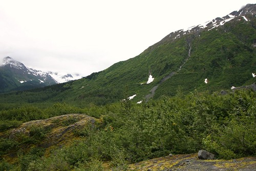
This next picture was my attempt at capturing evidence of forest succession. On the opposite ridge, you can see "lines" in the vegetation that draw a crude outline of where the edges of Exit Glacier were at some point in the past. As you follow the opposite ridge from right to left, near the left edge of the photo the height of the vegetation suddenly increases, giving a clue to where Exit Glacier previously terminated. Also, as you go up the opposite ridge the type of vegetation changes, giving a clue to the height of Exit Glacier at some point in the past. If you are not sure what I am referring to, then click the picture (or here) and it will take you to my Flickr page for this photo where I used the "note" feature of Flickr to point out these "lines".
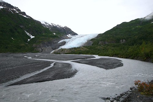
At the end of the spur road, there is a visitor center and a couple trail heads (the National Park Service provides an interesting birds eye view map (PDF) using an aerial photograph). One trail leads you to the top of the ridge where Exit Glacier slowly oozes out of the Harding Ice Field. That sounded immensely interesting, but we did not have the time to invest for that hike. Instead we chose the very easy and quick trail to the terminus of Exit Glacier. Although they do not allow you to walk up and touch the glacier (too much risk of a chunk of ice breaking off and landing on you), you can get close enough to feel the cold of the ice.
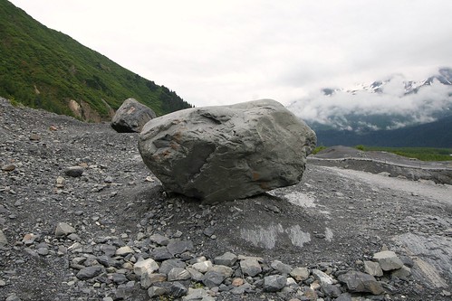
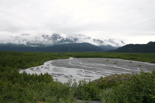
Here are two more photos, these with the glacier at my back. The first shows a nice sized chunk of rock that was left by the glacier. The second shows the outwash plain (or sandur) of the glacier.
Showing posts with label Glaciers. Show all posts
Showing posts with label Glaciers. Show all posts
Aialik Glacier
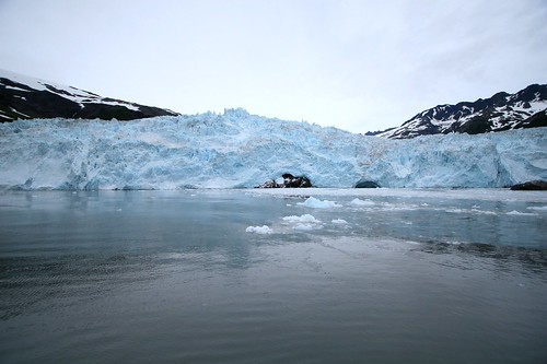
The boat trip we took from Seward was ultimately headed towards Aialik Glacier. This is a tidewater glacier. It terminates into the waters of Aialik Bay, and the tour boat could get fairly close to it.
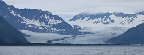
Contrast that with Bear Glacier which had receded from the shoreline and there is now a lake and a thin strip of land between the glacier and Resurrection Bay. This is a distant photo of Bear Glacier as we cruised by. You can see its racing stripes (the dark line up the middle...called medial moraines). This occurs when two glaciers merge and their lateral moraines have gone from being on the outside of each individual glacier, to instead being on the inside of the combined glacier. If you look closely at the photo, you can see that there are two racing stripes at the very bottom of the glacier, and only one further up. The second racing stripe comes from a third glacier merging into the larger glacier (coming in from the left near the bottom).
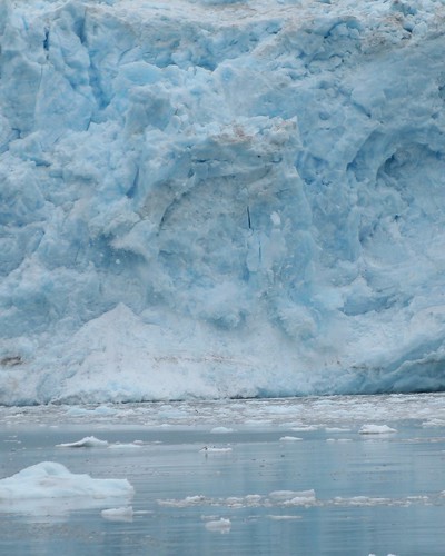
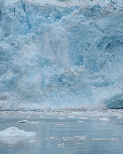
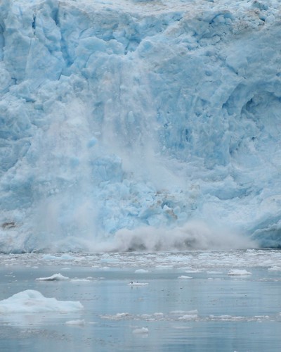
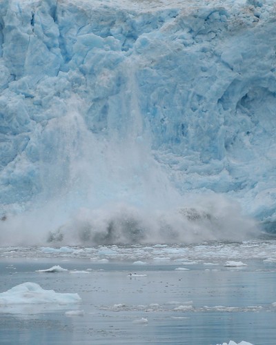
When we got to Aialik Glacier, the captain cut the engines off and we just floated. Similar to when we stopped to watch the Orca, the silence was punctuated by the occasional sounds of Mother Nature. This time, instead of the sounds of whales breaching, the sounds were the very loud pops and groans of the glacier as it inched its way towards the sea. Every now and then you would see bits of the glacier crumble away into the water. Usually it was small debris that chattered as it rolled down the face, but every now and then it was a larger piece that calved off with a dramatic roar.
Kenai Fjords National Park
Our main purpose for visiting Seward was a boat trip. We signed up for a boat tour into Kenai Fjords National Park. This National Park was established in 1980, and most of its land is covered by the Harding Icefield. There is only one road in the park (which gets you very close to Exit Glacier). Your only other choices are visiting the park by foot or boat.
Several boat tours operate out of Seward. We elected to go with the aptly named Kenai Fjords Tours. They offered an 8.5 hour excursion with the chance to see lots of wildlife and several glaciers, and provided a couple of meals. They delivered on all counts, and I have no complaints. The target glacier for the trip was Aialik Glacier. My home-grown Google map shows where that is relative to Seward.
Neither Tammy and I have much experience on boats. I had previously taken a pelagic trip while in Maine for the 2006 ABA Convention. And Tammy had taken some type of boat trip into the ocean off of the coast of North Carolina at some point before we met. But that was about it. We are landlubbers. So we were just a tad nervous about this particular boat trip.
We knew we needed to dress for cold and wind and possible rain, and we were successful on that point. There were others on the boat that stayed on the inside, where it was warm and dry, because they did not come prepared. I am sure their experience was just fine, but I am glad that we had prepared such that we could stay outside the entire time (even when there was a light rain).
Also, neither of us were sure we would not get seasick. We fretted a bit over what to eat in the morning, and we even took a non-drowsy Dramamine before we got on the boat (if you take them after you feel ill, it is too late). We ended up being fine and did not feel ill. In hindsight, we probably did not even need the Dramamine.
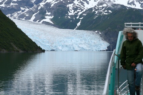
My next several posts will share pictures from this boat trip. For this post, I wanted to share a picture of the boat we were on, but I did not take any pictures of it. Sheesh. Apparently, all my photos were of things away from the boat. I did, however, find this photo of Aialik Glacier that I took as the boat approached. You can kind of see the side of the boat, but one of our fellow tourists is there too. I needed a nice warm hat. He seemed to be fine with just the hair. Hmmm...maybe I should have cropped this photo...
But never mind him! check out that glacier!
Driving To Seward
We were now one day closer to our boat trip. The boat trip, however, departed from Seward, so this day was all about driving from point A (Anchorage) to point C (Seward) with a short side trip to point B (Portage Lake).
View Larger Map
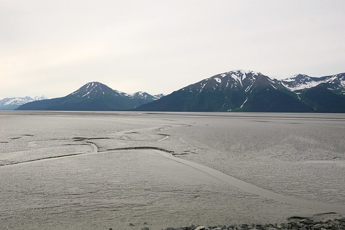
This drive took us past Turnagain Arm (again). Since it was another mostly cloudy day, and the tide was out, it looked the same this day as it had on our previous visit.
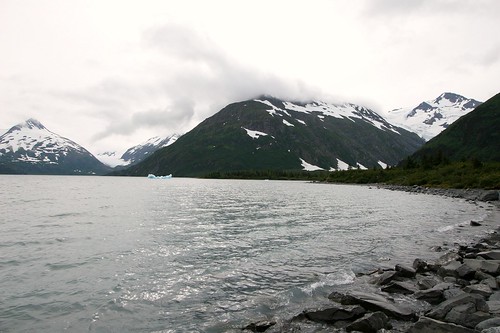
My previous post of the horse shaped iceberg (or is it dragon shaped?) was from the short side trip to Portage Lake. Here is a wide-angle view of Portage Lake, taken from the Begich, Boggs Visitor Center. The distant glacier in this photo (middle left) is actually Burns Glacier, not Portage Glacier. About a hundred years ago, Burns Glacier flowed into Portage Glacier, and Portage Glacier terminated close to where this picture was taken. Since then, Portage Glacier has receded considerably (nearly 5km), exposing Portage Lake along the way. It has, however, been fairly stable since 1999. While the retreat of Portage Glacier was helped by a warming climate, the main driver was the transition from a land-based terminus to a water-based terminus. Said another way, glacier ice calves more frequently in water than on land. You can read a more thorough history (and see historical photos) here.
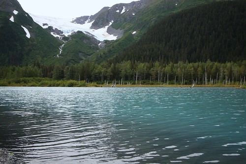
We also stopped to experience the quiet beauty of a lake with views of Explorer Glacier. We could have sat here for hours, but lack of food and the desire to arrive in Seward urged us onward.
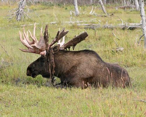
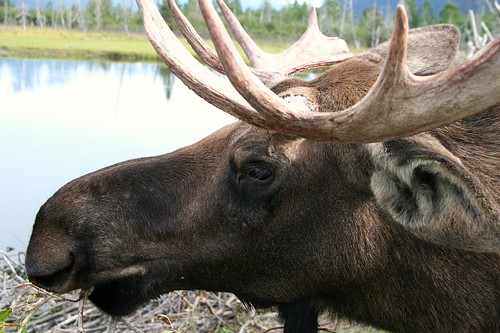
After our little side trip to Portage Lake, we got back onto the main road heading south towards Seward. Soon after that we discovered the Alaska Wildlife Conservation Center (AWCC). They are a non-profit that takes in injured and orphaned animals. Those that cannot be released back into the wild are given a home on the AWCC property. You can drive or walk through and see Moose, Elk, Black Bear, Grizzly Bear, and a few others.
I am glad that there is a group like the AWCC to care for these animals. I suspect that without the AWCC, these animals would not be alive. But seeing wild animals kept behind fences has always been a bittersweet experience for me. As much space as the AWCC provides these animals, they are still stuck behind a fence. Ah...if only the world was the perfect place I wished it would be ;-)
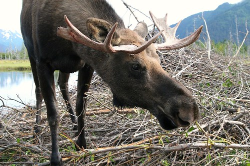
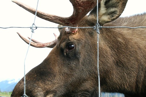
The resident Moose seemed very used to humans. They would saunter up to the fence even when people were nearby. We got a nice face-to-face encounter with a Moose.
Other than good judgment (and a dose of fear), there was nothing preventing me from reaching through the fence to touch this really large animal. I saw some others doing that very thing later in our visit, but that fence did not seem to really provide much of a barrier. Moose are BIG, and they have pointy antlers.
Subscribe to:
Posts (Atom)
