Home

I am home from Oregon. The trip was a blast and I hope to go back and explore more of that wonderful state.

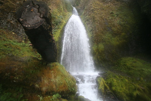
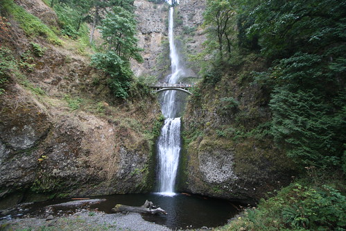
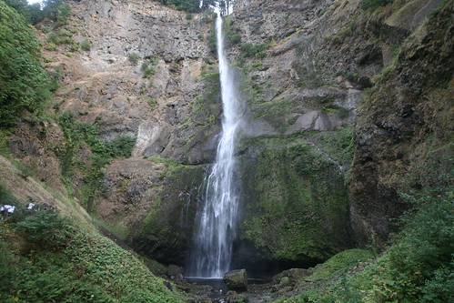
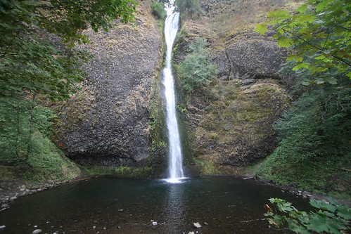
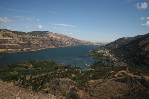
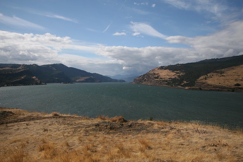
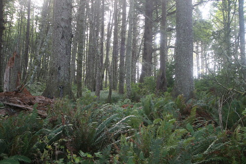
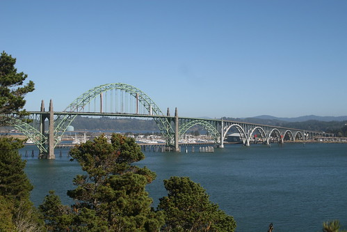
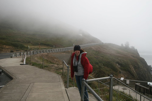
The travel home was interesting as ever. It was a two leg trip, first from Portland to Atlanta, and then Atlanta to Richmond. As usual, Atlanta was very busy and stuff towards the end of the day started to get delayed. Our flight to Richmond was caught in this. We ended up leaving Atlanta about 90 minutes late. And the best part was me noticing our luggage on a cart on the tarmac as the plane pulled away from the gate. Great.

When we did get to Richmond, I was not relishing the thought of having to repurchase my entire toiletry bag (including electric razor). I am flying to Dallas tomorrow for work, and since you have to put toiletry stuff in a checked bag these days, I appeared to be ready for a shopping binge. This story, however, has a happy ending.

The Delta lost luggage lady said our baggage was put on the next plane to Richmond, that was landing as she spoke. We hung around the baggage carousel in Richmond for another hour until our bags did in fact show up. Yeah!

Some odds and ends that I noticed on the trip home:
  • Richmond airport does not charge for wi-fi. Portland airport does not charge for wi-fi. Atlanta airport does charge. Lamers!
  • The Richmond airport is being remodelled. During the week we were in Oregon, the baggage carousels were moved from their temporary home to their new permanent home. It was like a different airport when we returned.
  • One of the new baggage carousels in Richmond broke tonight. This was while about 500 people (several flights came in about the same time) milled around, most very annoyed, wondering why it was taking so long to get their bags.
  • Richmond lets you pay for your parking while in the terminal. You can also pay for your parking when you drive out of the airport. You cannot pay for your parking in the parking garage.
  • When you pay for your parking in the terminal, you have 30 minutes to get out of the airport, or they will charge you more. You had better have your baggage before you pay for parking in the terminal.
  • Paying for your parking in the terminal is harder now because the signs point to pay machines that are not there. This is because of the remodelling, but still highly annoying.

Bridal Veil Falls


We were tired, and had seen enough waterfalls. They were all starting to look alike. The Bridal Veil Falls were the last for the day.

Wahkeena Falls

Wahkeena Falls

These are the Wahkeena Falls, a mere 242 feet.

Multnomah Falls

Multnomah Falls
Upper Multnomah Falls

The Multnomah Falls are actually two separate falls. The upper falls are 542 feet, and the lower falls are 69 feet. The second picture is only of the upper falls, taken from the bridge you see in the first picture.

Horsetail Falls

Horsetail Falls

Along the drive west to Portland along the south bank of the Columbia River there are several waterfalls that are very easy to see. This is Horsetail Falls, located right next to the road. It is 178 feet tall.

Views of the Columbia River

View from Rowena Crest
Looking West

Once we had found the Columbia River, we travelled west along its south bank until we got to Portland. Along the way we had some good views from the sometimes very high bluffs.

The first picture was taken from Rowena Crest, looking east. The second picture was taken from a roadside pullout closer to Portland, looking west.

Leaving Bend

Snowy Cascades
Eastern Oregon
Sun Bleached Bones

We left Bend by driving North to The Dalles (how many towns can you think of that use the word "The" in the name?) on the Columbia River.

As we left, we noticed that the mountains to the west had gotten some good snow overnight. Today was nice and sunny, so you could actually see a few miles, and thus see the snow covered mountains.

Further north, the drive was through rolling farm land that is typical of eastern Oregon. Trees were nearly absent. At this road side pullout we were lucky enough to find some good bones so that my pictures had a good desert feel to them.

McMenamins

McMenamins Room
McMenamins Bathroom
McMenamins Quote

While in Bend, we stayed at this cool hotel run by McMenamins. They are a bar/restaurant chain. They brew their own beers. They host regional band tours. And they also turn old buildings into hotels. Such was the case in Bend. We stayed at the Old St. Francis School.

I was thinking this was going to be cheesy. I was quite wrong. The pictures are our room. Each room was named after someone who was associated with the school somehow (ours was The Hoaglands or something...two sisters who attended the school before it became the "old" school and was turned into a bar/hotel). It was a very neat place to stay.

[edit 06.30.07: Just noticed that the title of this post was misspelled :-)]

Slow Day in Bend

So, with our bird watching venture a bust, we ended up just laying low today. There was some exploring of Bend. There was some window shopping. There was some very light sleet and snow. There was some napping. There were very few pictures.

Middle of Nowhere

Totalled
Nothing There

We ventured out in search of a bird watching spot that we had read about south of Bend. It is located in a small campground in the middle of Deschutes National Forest. The trip there, and our eventual discovery of the campground, have confirmed that the alternative name for this place was "The Middle of Nowhere".

Next to the campground was a park maintenance area that had been closed. If you read the description of the campground on the park web site, you will see that it is likely to be discontinued. I am thinking that might have already happened.

We did see some signs of life. There was a tent on the left side of the dirt road (opposite side from the camp ground) with lots of trash laying around it, but no sign of a human (other than the tent). In the camp ground itself there was a tent pitched next to a couple of cars (an old white van and some variety of Subaru, also old...both were full of junk). I did not stop to converse, but it had the look of a permanent residence for someone. And there was this car by the side of the road. I made a mental note to not dilly dally because it appeared likely that we would be attacked by vagabonds if we gave them any opportunity.

So, we found the campground, but there was no sign of the bird watching blinds described by our source material. I was too freaked out by the squatters to ask them for guidance. But it was a pretty place.

McKenzie Pass

McKenzie Pass
Snow at McKenzie Pass

The drive to Bend crossed over McKenzie Pass. This scenic drive would have been interesting just because you pass through a lava field (from an eruption about 1500 years ago), but we timed it perfectly so that we would get caught in the beginning of a snow storm. It was very cold, very windy and the snow was just starting to fall. The snow was nothing but interesting to us as we were headed down the mountain, but elevations over 5000 feet ended up getting several inches of snow.

Proxy Falls

Lower Proxy Falls
Upper Proxy Falls
Pool at bottom of Upper Proxy Falls

The third waterfall stop was actually two different falls: Lower Proxy Falls and Upper Proxy Falls. A short circuit hike will take you past each.

The third picture is of the pool that the Upper Proxy Falls drains into. Notice anything weird? The picture may not make it easy to tell, but the water flowing in on the right side never flows out of the pool. It must "drain" straight down into the volcanic rock. My first theory was that someone had installed a submerged pump that pushed the water back to the top, to tumble back down again. But I found no evidence of a pump or pipes, so I came up with that other, less interesting, theory.

Sahalie and Koosah Falls

Sahalie Falls
Koosah Falls

On the drive to Bend, we drove through the Cascades. The drive itself was very scenic, but we also stopped to check out some waterfalls that were fairly easy to get to. The Sahalie and Koosah Falls were within a half a mile of each other, both on the McKenzie River. The first are the Sahalie Falls. The second are the Koosah Falls.

Bridges of Cottage Grove

Reflected Bridge

Just south of Eugene Oregon, there is a little town called Cottage Grove. One of its attractions is a self guided tour of covered bridges in the vicinity. Before getting on the road to Bend, we took some time to go see a few of these bridges. I liked this picture because of the reflection of the bridge in the water.

Elk Herd

Elk Herd

After we started heading inland, we came across this herd of Elk that were grazing on Bureau of Land Management property near Reedsport. I realized that I had not taken any pictures this trip of something with hooves, so I had to stop and snap a photo.

Giant Dunes

Dune Climb
Oregon Dunes

How could something so large be so hard to find?

One of the last things that Tammy and I planned to do on the Oregon coast before heading inland was to explore some piece of the Oregon Dunes National Recreation Area. The travel book we had purchased described one hike in particular that we wanted to try. Not too long, but enough to get us out into the dunes in an area that was not plagued by dune buggies. So we dutifully followed the directions in the book. This took us down route 101 where we...did not see the landmark.

We knew there were dunes just beyond the trees that the road ran through. We could sometimes see the giant piles of sand. But we could not seem to find the trail that our book described.

After three trips up and down the same 10 mile stretch of route 101, we finally stumbled across the trailhead...in a different place and with a different name than what the book had printed. Sheesh.

This Is Disturbing

Disturbing

While on Cape Perpetua, another visitor noticed my American Birding Association gear and we started talking birds. They ended up giving me directions to Heceta Beach where I spied a few birds that I had never seen before. This bird, however, caught my eye because he is in a very bad way and there is not much that can be done about it.

While I was at this park, a lady parked nearby and proceeded to do two things that annoyed the heck out of me. First, she fed the birds bread by hand. Second, she then took her two dogs for a walk unleashed.

Why am I so bent out of shape? Feeding birds by hand may seem cool and nice and gentle, but what you are really doing is training the birds to associate humans with very easy food (and usually food that it not healthy for the birds, although they do not know that). When I got out of the car at this park, several birds immediately flew over and walked around behind me. Some were so close that I could not take their picture with my 100mm lens. They were obviously not very afraid of me.

Back to this lady. After she fed the birds (which caused the bird I was watching in my scope, a species I had never seen before in my life, to fly over to her for a quick meal of bread) she unleashed her dogs and took a walk along the shore. Birds fly in for food, and then fly away as dogs chase them.

The bird in this picture was more than likely not afraid of humans, came nearby and decided that the thing flying out from the human was just another piece of easy food. He had no idea that it had a hook in it and was attached to a fishing line. The line has been cut, but the hook remains. Who knows how long he has been this way? I have a feeling that his beak cannot open enough for him to feed and he will eventually starve to death.

Sea Lion Cave

Is It Worth It?
The Elevator
Sea Lion Cave

Sea Lion Cave is pure tourist attraction. You come across it in the middle of nowhere as you drive south on route 101. Beneath the gift shop, they have built an elevator that takes you something like 200 feet down to a museum and platform that has a view into a sea cave on the Oregon coast. It is called Sea Lion Cave for obvious reasons: Sea Lions like to hang out there.

Tidepool

Starfish
Starfish
Tidepool

If you arrive at Cape Perpetua when the tide is low, you can explore their Marine Garden. What this means is that you can climb out on the coastal rocks far enough to see the things that are stuck in tide pools when the tide is out, but not actually be in the water yourself. The trick to this is that you need to watch your step so that you do not step on anything living, and watch the surf so that you do not get clobbered by a wave (which would probably be very life threatening if you got knocked into the ocean).

Inching Along

Inching Along

This little guy was on a fence at the top of Cape Perpetua. It seemed like he might be in a hurry.

Views from Cape Perpetua

View from Cape Perpetua
Cape Perpetua Forest

Cape Perpetua is the highest point along the Oregon Coast. The first picture made me very nervous. Just a couple more steps forward and I would be wishing I could fly. The second photo is an attempt to capture the light filtering through the vegetation on the cape.

Time Machine

"Tonight" as I was posting pictures that I took on Tuesday while in and around Newport, I got all confused. My PC still thinks I am on the east coast, so the post I made about sunset on Tuesday showed up in my blog under Thursday because I wrote the post very late Wednesday night west coast time.

I woke up "tomorrow" morning thinking about this and ultimately decided that I wanted my pictures to show up on the day that I actually took the photo. So I turned on the "time machine".

When you post a new entry to your blog, the Blogger system will automatically assign it the current date and time. But the "time machine" feature lets you set the date and time of your post to anything you want. I went back to all of the posts I have entered so far on this trip and changed the date and time so that they would appear in the blog on the day that the picture was taken. None of the posts that were there have disappeared, and other than this one there are no new ones as a result of the "time machine".

So, as of this post, I am a day behind. There are no posts yet for the stuff that we did "today".

Hotel Room Sunset

Newport Sunset

I managed to take a few pictures of the sun setting over the Pacific Ocean from the hotel room Tuesday night. It was not a super colorful sunset, and there were clouds obstructing the sun as it disappeared behind the ocean, but it was a sunset. This picture was my pick of the litter.

Bridge over Yaquina Bay

Bridge Over Yaquina Bay

This bridge carries route 101 south over Yaquina Bay. Newport is to the left. This picture was taken from Yaquina Bay State Park

Views from Agate Beach

Agate Beach
Agate Beach

Agate Beach is located a few miles north of Newport. It is very wide, with enough sand to form some small dunes, and wonderful views of nearby mountains. One of the travel books that we bought suggested that you might actually find agate on this beach, but we had no such luck.

Cobble Beach

Yaquina Cobbles
Cobble Beach

Below Yaquina Head Lighthouse there is a cobble beach that you can explore. A cobble beach is simply a beach made of small round stones, about the size of golf balls. The wave action erodes the "corners" of stones to make them round. The sound of the waves on a cobble beach is weird because the stones actually get moved around. And finally, these stones are really difficult to walk on.

Yaquina Head Lighthouse

Yaquina Head Lighthouse
Foggy Lighthouse
Leaning Into The Wind

As I mentioned yesterday, the visit to Yaquina Head Lighthouse was filled with wind and fog. You are allowed to climb up the lighthouse, but they were limiting the number of people to a few at a time (because of space limitations). Because everyone wanted to get out of the cold wind, there was a line to climb up into the lighthouse. We were impatient and skipped that.

Despite the gloomy weather, there were a few photos that are worth posting. The first two are of the lighthouse itself, with appropriate amounts of fog. The third photo is an attempt to show the wind blowing, using Tammy as an action figure model.

Not Enough Time

I am too busy taking pictures to be able to post blog entries for the ones I think are interesting. Today was a busy picture taking day. I still have pictures from Yaquina Head Lighthouse (despite the fog and wind), Agate Beach, Yaquina Bay State Park and sunset from the hotel window. There are probably another six or seven blog posts from those, but it is getting late. I will have to post them tomorrow at some point.

Speaking of tomorrow...Tammy and I leave Newport tomorrow morning and head east across the state. Actually, we will head south towards big sand dunes, and then east towards Eugene where we will spend the night. This will be the first half of our move across the state to Bend, where we will spend a couple nights.

Goodnight for now. More pictures from today will be coming tomorrow. At this rate, I will be posting pictures from this trip after I get back home. But all the thumbnail versions of pictures I have taken are online at the moment (the full sized images are not...still 486 of those to upload). You can find the thumbnails for the Orgeon trip here.

Views from the Punchbowl

View from the Punchbowl
Punchbowl View

Here are a couple of pictures I took at the Devil's Punchbowl State Natural Area. They are pretty nice views especially with the fog and clouds.

Plump

Fat Squirrel

At the Devil's Punchbowl State Natural Area there was a very fat squirrel that was living in the park. He kept coming out of the bushes onto the paved path, obviously wanting to be photographed. Very fat.

Devil's Punchbowl

Cave in
Road No More

North of Newport is a little park that exists primarily because of the remains of a sea cave that collapsed. Now there is a big hole in the ground that is walled in on all sides except for one little piece that the ocean comes in and out of with the tides.

That was not a good description. Look at the first picture. The second picture shows what used to be part of the same sidewalk I was standing on. Hmmmm....