In contrast to the cold overcast that joined me at Wetlands and Pony Pasture, a recent visit to Pocahontas State Park was nothing but sunny with strong hints of spring. Pocahontas State Park is mature forest, with bits of logged forest, a pinch of marsh, and even a drop or two of lake. There are several trails accessed from the heart of the park (all three miles or less - PDF map here). Or, if you are looking for a longer visit, a network of fire roads crisscross the park.
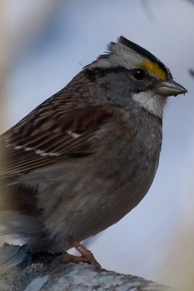
Here are a few of the noteworthy observations from my February visit to Pocahontas. For starters, this White-throated Sparrow flushed up into a nearby tree, and then sat, warily watching me from its perch.
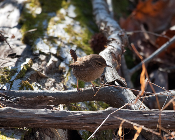
As Tammy and I walked one of the trails, I was delighted to find a Winter Wren in a pile of brush next to the trail. We stood on a short bit of boardwalk (which was very low to the ground) while the wren worked up its confidence to the point of taking cover under the very boardwalk on which we stood.
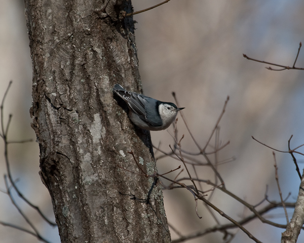
This White-breasted Nuthatch was cruising the trees next to one of the lakes, showing off its talent for walking down trees beak first.
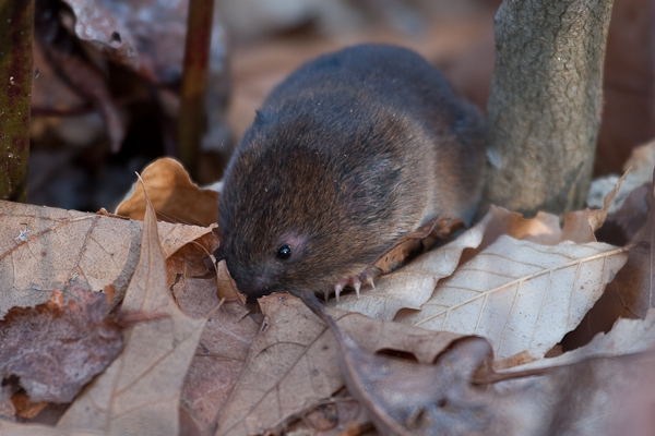
At one point, Tammy and I stood watching several distant Red-headed Woodpeckers. While watching, however, I heard rustling in the leaves right at our feet. Without moving, I did a bit of searching and discovered this critter (I think it is a Meadow Vole) hanging out in the leaf cover.
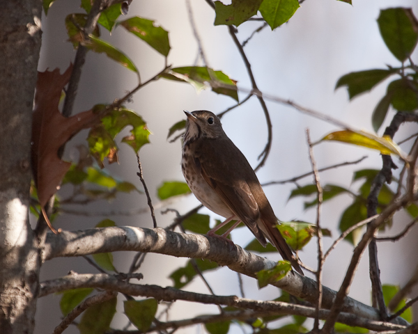
This Hermit Thrush flushed into the relative safety of some variety of Holly, and then sat...very...still...while I snapped a few photos.
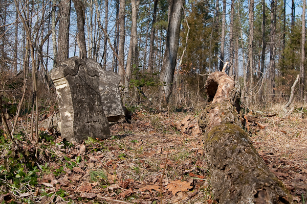
While the land was not managed as a state park until 1946 (donated to the state of Virginia by the National Park Service), it was originally developed by the Civilian Conservation Corps in the 1930s. My last photo is of an old grave site located within the confines of the park, a testament to one of the families that lived on this land before it was converted into the park it is today. In this case, it is the Gill family, with the front marker dated 1872.
Showing posts with label Cemeteries. Show all posts
Showing posts with label Cemeteries. Show all posts
Doyles River Loop
A couple weeks back Tammy and I hiked Doyles River Loop in Shenandoah. We actually hiked a variant that began at Browns Gap instead of the Doyles River Overlook. This variant hike was described as being 2 miles shorter than the real hike of 7.8 miles. At the end of the hike, however, my GPS said we had hiked 7.3 miles, only half a mile less instead of the predicted two miles less. So either we took a wrong turn, my GPS is screwy, or the book was wrong. I am voting on #3.
Despite the additional mileage, this was a great hike. It was a warm day and we finished very tired, but there were good things to be seen the entire hike. For example, as I mentioned above, the variant hike began at Browns Gap, following the old Browns Gap Turnpike down the mountain. It is now a fire road for the park, but it was originally constructed by the Brown family to move produce. During the Civil War, however, it was used by Stonewall Jackson to move troops. A little ways down the old road, there was a clearing on the left side where someone had taken care to preserve a grave marker. There is no date on the marker, but the individual, one William H. Howard, succumbed to something on this road and was laid to rest here. According to the marker (and this web page), he was in Company F ("The Fluvanna Hornets"), of the 44th Virginia Infantry, of the Confederate States Army.
Eventually the old turnpike crosses the Doyles River Trail. We turned right on it and followed it down, past a couple "could have been nice" waterfalls until it turned into Jones Run Trail and began to ascend. This took us back up the mountain, again past several "waiting for rain" waterfalls, until we got to the Appalachian Trail. We then followed the Appalachian Trail back to the car at Browns Gap.
The number of significant waterfalls on this hike makes it something to return to at some point in the future. On this day, there just was not very much water flowing in the streams. A couple of the waterfalls were just rock walls with no water. In the future, when the weather has not been so dry, a return trip should allow us to see water falling.
Here are a couple of photos from the start of the hike. The first shows the sign for "Brown Gap". All the books, and online maps, show this as "Browns Gap", but the sign on the Skyline Drive did not include the "s" on "Brown" for some reason. The second photo is of the grave marker I described above.


Monticello


Today was a very nice, unseasonably warm day, so some sort of outdoor activity was on order. After some brainstorming, it was decided that a visit to Monticello would be that activity. Monticello is located just outside of Charlottesville, so it was not a very far drive to get there. While I cannot say that I left the place stunned with the awesomeness of its history, it certainly did the trick in terms of "something to do on a nice warm January day". They will not let you take pictures inside the house, but you can take pictures on the grounds. Bummer! I wanted to take a picture of the cool clock, the small beds and that cool letter copying machine that Jefferson used. Here are a couple photos from the grounds, including the gate of the small cemetery in which Thomas Jefferson is buried.
Jefferson Davis
Here lies Jefferson Davis. His grave was one of the better manicured in the cemetery. If you follow the above link and read about his funeral, it says
His funeral was one of the largest ever staged in the South and ran a continuous march from New Orleans to Richmond, Virginia day and night.
Pretty Realistic
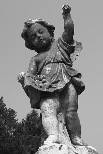
The combination of the detail in this statue and the black and white image makes it easy to trick yourself into thinking that this is a real person sitting here.
Under Attack
The angle of this shot makes it look like the statue is throwing something at me.
I wish I could say something artistic sounding on why I chose to take this picture in black and white. In reality, I simply learned how to make my camera take pictures in black and white, and therefore had to exploit that knowledge.
James Monroe
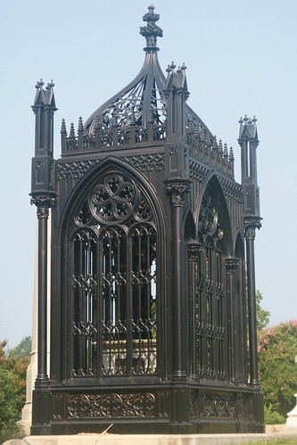
Hollywood Cemetery is where the remains of James Monroe are located. The plaque on the ossuary reads:
James Monroe
Born in Westmoreland County 28" April 1758.
Died in the City of New York 4" July 1831.
By Order of the General Assembly
His Remains were removed to this Cemetery 5" July 1858.
As an evidence of the affection of Virginia
For Her Good and Honored Son
Hollywood Cemetery
Tammy and I decided to go to Maymont Park today, but it did not open until 10am. Since we were out and about around 8:30am, we had some time to kill. So we decided to pop into Hollywood Cemetery and explore a little before going to Maymont.
There are plenty of creative photographic composition opportunities within Hollywood Cemetery. I tried to capture a few.
Subscribe to:
Posts (Atom)
