Fall Foliage

Back in November, on a Sunday after a home football game at Virginia Tech, Tammy and I made our way back home via the Blue Ridge Parkway, heading north from Roanoke. The fall colors were still vivid, and this drive gave me the opportunity for several photos.

The pictures almost did not happen, however, since the morning started with my camera giving me fits (the "dreaded" Canon error 99). A couple quick emails later with Rich, and he had provided me with a nice set of troubleshooting steps that eventually got my camera back in working order.

Speaking of pictures. In my last post I mentioned that a change at my current photo hosting company has led to the decision to switch to Flickr. I have begun the massive effort of moving all my photos to Flickr. As I write this post, I have uploaded 7900 pictures to Flickr (spanning from 2005 through the Rapidan Loop hike from July of this year). I still have the remainder of the photos from this year to get uploaded before I begin to convert the posts in this blog to reference Flickr hosted photos. My goal is to have all my pictures uploaded to Flickr before my next trip (flying to Miami on New Year's Day...next Tuesday!) so that whatever pictures I take on that trip go straight to Flickr. I have no idea how long it will take me to convert this blog :-/

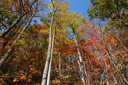
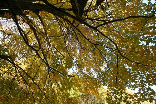
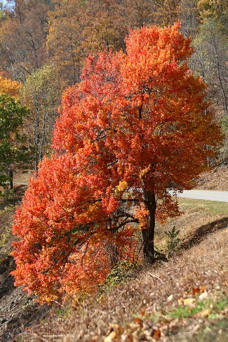
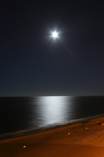
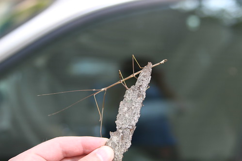
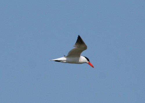
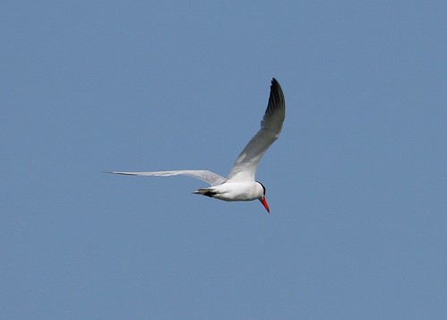
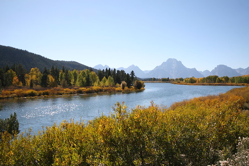
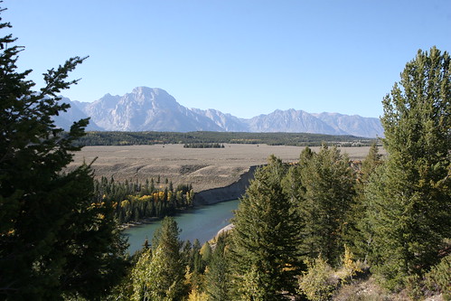
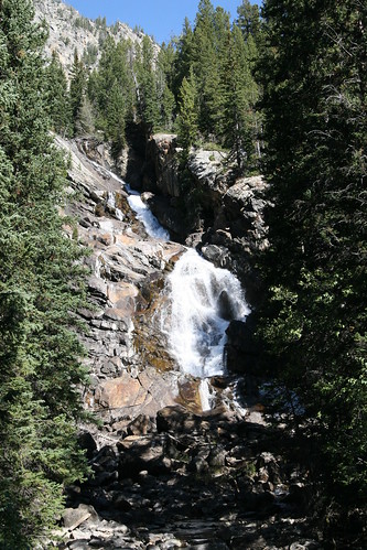
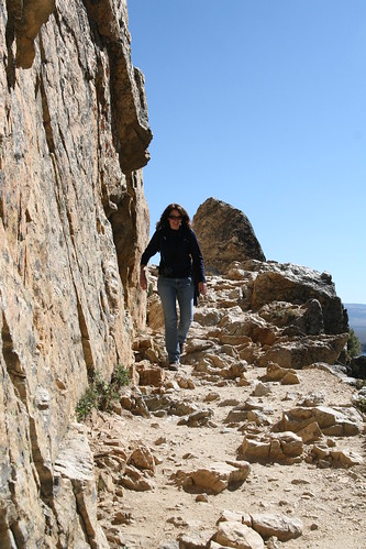
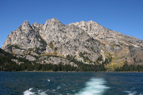
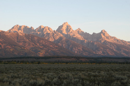
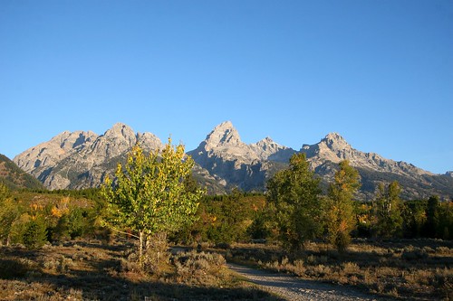
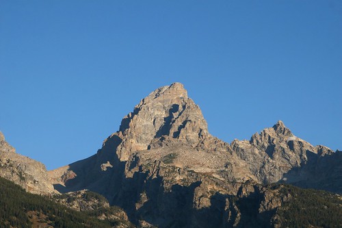
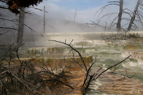
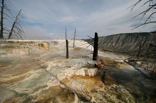
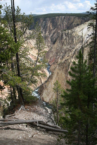
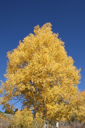
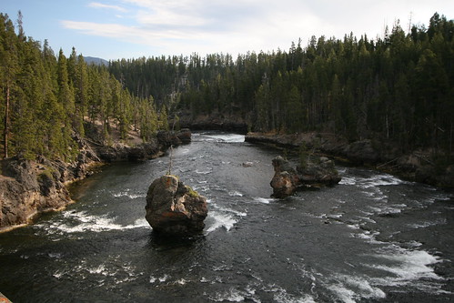
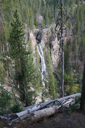
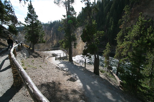
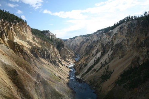
Anyhow, this blog post is about fall foliage. Here are a few photos of the leaves.

Fall Foliage
Fall Foliage
Vivid Tree

White Ibis (juvenile)

One interesting find in Chincoteague NWR, although definitely not an incredible find, was a small group of juvenile White Ibis. This species breeds in the southeast corner of the United States, but not as far north as Virginia. Their winter range still includes extreme southeast United States, but also the Caribbean, both Mexican coasts and a few bits of South America. In other words, range maps for the White Ibis never really show them occurring as far north as Virginia.

But they do. You can usually find them along the coast in late summer and early fall. I think the first year birds wander a bit after they leave their parents, and can end up in places like Chincoteague. These were roosting in a stand of trees by the road to the beach within Chincoteague NWR.

On an unrelated note, I will be changing the service that I use to provide online hosting and backup for all of the pictures I take. My current service (Phanfare) has announced some changes to its service that demonstrates to me that I am not part of their target demographic (photo sharing for friends and family...not photo hosting for someone who does not care who has access to their photos). Six months from now, all the links I have in this blog that point back to a picture hosted by Phanfare will break. Grrrrr! So, in addition to adding new blog content as I collect more photos (I am heading to Miami next...Go Hokies!), I will also be converting all my previous blog content (over 300 posts going back to 2005...sigh) to point to pictures that will eventually be hosted on Flickr.

[edit: it took me a day to figure out that the word "Caribbean" has one r and two b's, instead of the other way around :-) ]

White Ibis (Immature)

Bald Eagle

After my stay in Virginia Beach, I headed up the coast for a stay in the little town of Chincoteague, and the chance to bird Chincoteague NWR. The days were gray and overcast, so I did not really get many memorable photographs, but at least it did not rain. And yes, there were some birds to be seen as well. For example, a pair of Bald Eagles.

As I was driving through the NWR on the road towards Tom's Cove and the beach, I noticed a Bald Eagle standing in the little bit of water that remained in the marsh. To me, this was a fairly odd place to see a Bald Eagle (not odd to see one at Chincoteague in general, but odd to see one standing in water). I watched for a bit, took the blurry picture below (sigh), and then watched as the bird flew up into a nearby stand of pine trees. That is when I noticed the second eagle (and took the second photo). They make a nice couple.

Bald Eagle
Bald Eagle Pair

Nobody Home

During my September visit to Back Bay NWR I noticed this light colored, football shaped thing in some nearby mud. A look through my binoculars told me what it was: the bleached out shell of some variety of turtle. I have seen and photographed plenty of turtles, but they were always alive, sunning themselves or in a hurry to some important date. This is my first dead turtle. Or, what remains of a dead turtle. There is nothing left of this guy but his big bleached out shell. Makes me wonder where all the other dead turtle shells end up. Probably under water and buried.

Nobody Home

Prey and Predator

After I had hiked out and back on the Dike Trail at Back Bay NWR, I walked the Bay Trail (which is mostly boardwalk) behind the visitor center and parking lot. Along one section of the Bay Trail I noticed lots of large grasshoppers on either side of the boardwalk. As I walked along they would occasionally spook and propel themselves to some more comfortable resting spot. The first photo below is a photograph I got of one that decided not to vacate its current resting spot as I walked by.

Then I got to this sunny spot where a very large spider web was in the foliage on the left side of the boardwalk. Right in the middle of the web was a large black spider with a yellow pattern on his body (I think it is a Black and Yellow Argiope, also known as a Yellow Garden Spider or Yellow Garden Orbweaver). And the spider was occupied with a large meal. Caught in the spider's trap was one of those grasshoppers, its spindly legs clearly showing under the spider's binding silk.

Grasshopper
Spider
Spider

Yellow-billed Cuckoo

While I was staying in Virginia Beach, I took a trip out to nearby Back Bay NWR for some birdwatching and photography. This trip occurred in late September, so it coincided with fall migration. Because of fall migration, I did not really know what birds I might see. When you add the general dullness of fall plumage (when compared to spring plumage), and my challenges with field identification, I expected to have a fair number of "low confidence" birds, where I was just not quite sure of the identification.

One bird that I had no problem identifying was a Yellow-billed Cuckoo. In my experience, this species is fairly shy, often flying away into cover as soon as they spot you. Sometimes I spot them first, but usually not. Usually I hear them, especially when hiking during the spring and summer in Shenandoah. Their call is very distinctive, and once I learned it, it was very easy to detect their presence during the warmer months.

I feel like I got somewhat lucky in Back Bay. Not only did I see a Yellow-billed Cuckoo, I also managed to get a photograph of one. It is a tad "soft", but I don't care. Since I usually hear this bird, getting any picture is bonus to me. I think the bird I photographed is a first year bird (born this past summer) because the underside of his tail does not quite have the distinct black and white pattern of the adult bird. This bird was stopping over in Back Bay on his way to his winter home in South America.

Yellow-billed Cuckoo

Ocean Moon

After returning from the Yellowstone trip, I took the time to visit the eastern shore of Virginia for a few days. Part of my trip included a couple nights at Virginia Beach. Luck would have it that the skies were clear, the moon was nearly full and the moon was conveniently hanging out over the ocean at dusk and early night.

Moon over Ocean
Moon Over Ocean
Moon over Ocean

Northern Walking Stick

Through this past summer, as I have taken the occasional photo a butterfly, dragonfly, damselfly or something else, I have had to use various available resources on the Internet in order to identify what I was seeing. This often included me relentlessly perusing page after page of other people's bug photos in the hope of seeing something that was close to what I had photographed. This would sometimes get old, as my eyes teared up from the strain of oodles of bug photos. Or I would see some really neat looking bug that would distract me from my search.

One such neat looking bug that distracted me at least once was the Northern Walking Stick. I would see its photo, read about it, realize that they occur where I live, and then wonder why I never saw them. Maybe I just thought they were sticks on the ground and were ignorantly trampling them?

Then, this past September, when I returned home from my trip to Hog Island WMA, I was pleasantly surprised to discover a stick clinging to the side of my house. Not just any stick, but a Northern Walking Stick. Here are some photos of me and my new friend. It was an interesting challenge attempting to take pictures with a DSLR in one hand and this bug in my other hand, all while the bug tried to crawl up my arm! Guess which end is its head!

Northern Walking Stick

Caspian Tern

Hog Island Wildlife Management Area is located on the James River about halfway between Richmond and the Atlantic coast, very near Williamsburg, VA. I suspect that it is the proximity to the coast that makes Hog Island a pretty reliable place to see a few different species of tern, including Caspian Tern. I did a few queries within eBird and determined that Caspian Terns can be found at Hog Island during spring and fall migration, with August and early September being the best times to spot one.

As I mentioned in my previous post, my most recent trip to Hog Island was in early September. On this trip, I did see several Caspian Tern flying over the river. They were near to shore and a few were actively fishing. To fish, they would fly over the water until they spotted a likely victim. Once they had a target, they would hover a bit and then fold their wings in order to dive down into the water and, hopefully, catch some food.

Here are three photos of a Caspian Tern. The first two photos show a Caspian Tern in flight. The last photo shows one in mid-dive, on its way down to the river and hopefully a fish. Some clues that this is a Caspian Tern are the combination of black cap, black legs, and the large orange bill that has a darkish tip.

Caspian Tern
Caspian Tern
Caspian Tern

Blue-gray Gnatcatcher

Way back in September, before the trip to Yellowstone, I took advantage of the Labor Day holiday and visited Hog Island Wildlife Management Area. I was partly interested in seeing what birds might be seen, partly interested in getting a good photograph or two and partly interested in just getting outside and enjoying the peace of a nearly deserted park.

I was not disappointed. There were birds to be seen, a few of which got photographed, and it was a nice, quiet trip to a beautiful park. While I don't have a photograph that I can share to prove that the park was nice, or that it was mostly human free, I do have a picture of a bird. In this case it is a Blue-gray Gnatcatcher. The photos are a tad backlit, but the bird still has enough contrast to be clear and identifiable.

Blue-gray Gnatcatcher

Snake River

A couple posts back, I talked about the mountains of Grand Teton National Park. One of the other prominent features of the park is the Snake River. The Snake River originates in Yellowstone National Park, and flows south into Grand Teton National Park before turning west towards its eventual consumption by the Columbia River. It is a giant river system, with numerous dams constructed on it (I counted at least 20 when I read the Wikipedia page) to provide navigation, irrigation and electricity.

Here are two photos that include the Snake River as part of the scenery. These may be repeats from the Blog Action Day post, but since they were not previously described as pictures of the Snake River, I figured it was okay to show them again. On another note, I think I have reached the end of my posts about the recent trip to Yellowstone. My next post should jump back to things closer to home.

Snake River
Snake River and Tetons

Inspiration Point

There are a lot of trails in the vicinity of Jenny Lake, within Grand Teton National Park. There is even a ferry service across the lake if you want quick access to the far side. One of the popular destinations on the far side is Inspiration Point. There is a waterfall (aptly named Hidden Falls) on the way up, and the views from Inspiration Point are pretty nice. We ended up hiking to the far side, up to the waterfall and Inspiration Point, and then taking the easy boat ride back.

Part of the trail up to Inspiration Point is literally cut into the side of a short rock face. What is weird is that this caused me zero anxiety (unlike the trails that meandered next to the giant canyons of Yellowstone National Park). Tammy, on the other hand, was the exact opposite. She had no problem the meandering canyon-side trails, but the climb up and down from Inspiration Point was not quite as inspirational to her as it was to me.

The first photo here is of a shadowy Hidden Falls. The second is one of the views from Inspiration Point, looking east across Jenny Lake. The third photo is Tammy negotiating the climb back down from Inspiration Point. And the last photo is of the Grand Tetons, taken from the boat as we rode back across Jenny Lake.

Hidden Falls
Jenny Lake from Inspiration Point
Tammy descending Inspiration Point
Grand Tetons from Jenny Lake

The Magnificent Grand Tetons

After Tammy and I tromped around Yellowstone National Park for about four days (we could have spent twice as many), we headed south to Grand Teton National Park and Jackson, Wyoming. This is where we saw (and I photographed) the bull moose, was investigated by the pika with an unfortunate tick, and nearly stepped on that grouse.

Not counting the two travels days where we drove into, and out of, the park, we only gave ourselves one full day in Grand Teton National Park. That could have been two or three days given the amount of stuff we did not attempt to see or do in this park. The one thing, however, that you cannot help but see, and that steals the show, are the mountains themselves. They jut abruptly out of the terrain, with no surrounding foothills, always catching your eyes. You cannot help but watch them. Interestingly, they are part of a fault-block mountain system, formed not because two tectonic plates are colliding, but because the earth is being stretched apart.

On our one full day in the park, we got up early enough to catch the morning sun hitting the mountains. Here are some photos from that effort. The first photo is a repeat, first posted a few days back as part of Blog Action Day.

Teton Sunrise
Grand Tetons
Grand Teton

Mammoth Hot Springs Terraces

Just south of the village of Mammoth (where Tammy and I had a close-up view of an Elk herd) are the Mammoth Hot Springs Terraces. The terraces are formed when hot water carrying dissolved limestone is cooled, forcing the limestone to solidify.

The first three pictures are terraces formed from the active spring. The water from the spring had moved into a stand of trees. The steam from the hot water, the dead trees and the colored terraces gave this place quite an otherworldly feel. The fourth picture is of a "dead", bleached out terrace. It is no longer supplied with hot water because the springs have moved.

Mammoth Hot Springs Terraces
Mammoth Hot Spring Terraces
Terrace Close-up
Dead Terrace

Morning Glory Pool

On the walk from Upper Geyser Basin to Midway Geyser Basin, the trail takes you past Morning Glory Pool. This is a large hot spring that is a great example of how different water temperatures cause the different colors in the water. The blue water at the center, down towards the bottom of the pool, is the hottest. The more shallow yellow water, towards the edges of the pool, has a lower temperature.

This pool, however, is also a great example of how ignorance can permanently alter our landscape. Because people throw things into the pool, the vent gets clogged and the water temperature decreases in the pool. This results in less of the vivid blue, and more of the yellows and browns. The park service has actually "vacuumed" this pool's vent in an effort to keep it clear of the stuff humanity throws into it.

I never would have imagined that people would think it was okay to throw their trash into something as beautiful as Morning Glory Pool. Sheesh.

Morning Glory Pool
Close-up of Morning Glory Pool
Sign for Morning Glory Pool

Upper Geyser Basin

If you take the time to watch Old Faithful erupt, you might as well take some time to wander around within Upper Geyser Basin. Old Faithful sits on the edge of Upper Geyser Basin, and there are plenty of other geothermal features to see, including other less famous geysers. If you are really into it, then you could hike about a 5 mile loop that starts next to Old Faithful, wanders through Upper Geyser Basin down to Midway Geyser Basin (yeah...there is also a Lower Geyser Basin...but we did not visit that), and then comes all the way back to Old Faithful. That is what Tammy and I did.

One neat thing that the National Park Service did was put little signs up to tell you the name of the geothermal thing you were next to. I tried to take pictures of the sign when I took pictures of the thing, but, alas, I was not consistent. Sometimes I took a picture of the sign first. Sometimes I took a picture of the thing first. Sometimes I took no picture of the sign at all. So, what I ended up with was a bunch of pictures for things whose name I am not too sure about. [Edit: While fixing this post to point at Flickr, I was able to identify what was in the first and third photos. The top photo is of Belgian Pool. The bottom photo is of Spasmodic Geyser.]

Whatever the name of these might be, they are pretty interesting looking. The bluer the color, the hotter the water. The more brown, orange or yellow, the cooler (or "less hot") the water. All of these are located in Upper Geyser Basin.

Belgian Pool
Unknown Pool
Spasmodic Geyser

Old Faithful

I could not imagine visiting Yellowstone National Park and not taking the time to watch Old Faithful erupt. The National Park Service makes it very easy for you: tons of parking, lodging and restaurants within walking distance, schedules posted to help you time your visit, and even benches to sit on while you wait for the show.

Tammy and I planned our trip to Old Faithful so that we would see its eruption in the morning, hopefully early enough to miss the crowds, and then begin walking through the adjacent Upper Geyser Basin in order to see many of the other geothermal features that are neighbors to Old Faithful. Our planning worked out quite nicely, and we also got lucky. We got there early enough to beat the crowds (later in the day, it was very crowded), and managed, quite by accident, to walk up to the geyser viewing area about 10 minutes prior to its eruption.

Here is my proof that I was a good Yellowstone tourist and I took the time to watch Old Faithful erupt.

Old Faithful
Old Faithful
Old Faithful

Today is Blog Action Day

I am participating in Blog Action Day today. What that means is that today's post should be on a topic that is related to the environment. The focus of this blog is already about the outdoors, so relating today's post to the environment is no stretch.

I typically do not use this blog as a platform for preaching, or attempt to beat readers over the head with how I think they should live their lives. Today is a little different. I am sharing five photos (taken during my recent vacation to Yellowstone National Park and Grand Teton National Park) of what I consider to be beautiful examples of our environment. Examples that exist not because of humanity, but despite it. Our environment will not be preserved automatically. We must take steps to preserve it, or places like the ones I picture below will only exist in our art and in our memories.

Teton Sunrise
Yellowstone Canyon
Snake River
Aspen
Snake River and Tetons

Yellowstone Falls

When we hiked the North Rim Trail, we were excited (and nervous) to have the chance of observing both the Upper Yellowstone Falls and the Lower Yellowstone Falls from their brink (right as the water plunges over the edge). The wide open views and the significant elevation change was enough to make me extremely tense. The upper falls are 109 feet tall, and the lower falls are 308 feet tall. Despite my nervousness, I forced myself right up to the railing in order to look over the edge at the water plunging down to the bottom.

I suspect anyone nearby may have chuckled at my obvious, white-knuckled grip of death on the railing. On the other hand, I chuckle at the fact that I am scared of heights and have a blog titled "No Ceiling".

Anyway. I digress. I did take some pictures of the water at the top rushing over the edge, but the problem I am seeing now is that my pictures come nowhere close to capturing the enormity of the drop off. When I look at my pictures of the top of the waterfall, I get no sense of the canyon, or the change in elevation. There is nothing in the photos of the upper and lower falls to give me a sense of scale.

But that does not mean there are no pictures worth sharing. Here is a sample of the views from the hike along the North Rim Trail. These pictures are:
1. Looking downstream at the start of the hike.
2. Crystal Falls.
3. The viewing area at the brink of the lower falls.
4. The canyon downstream of the lower falls.

Yellowstone River
Crystal Falls
Brink of Lower Yellowstone Falls
Canyon Below Lower Yellowstone Falls